

CIOOS Data Tools
Data Explorer
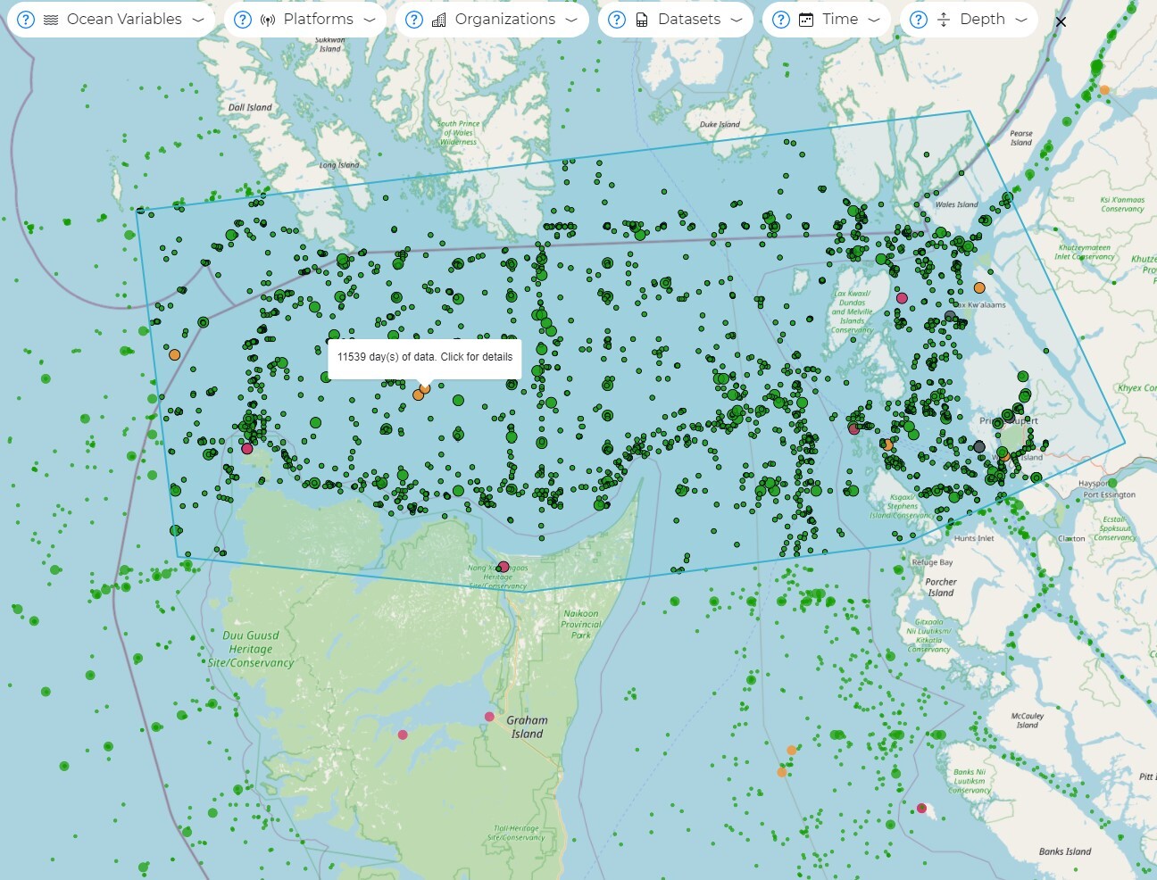
Use the map to search geographically for data, across supported datasets. Filter, aggregate, and download just the data that meets your criteria. Data Explorer downloads are in a standardized (.csv) format.
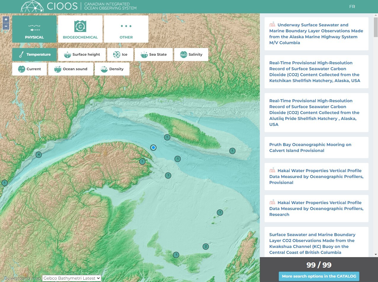
Catalogue Map
Use the interactive map to search geographically and find complete datasets. Find the datasets in their original format; many can be converted to a format that meets your needs.
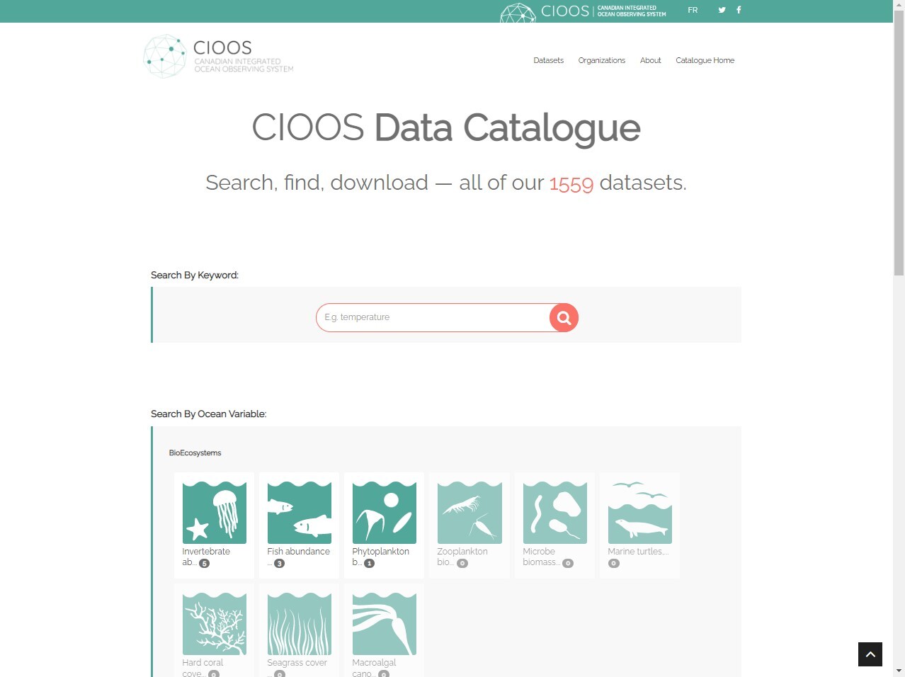
Data Catalogue
Use filters and keywords to search the full collection of CIOOS datasets across Canada. You can use the catalogue to find the data or metadata in its original format, and many can be converted to a format that meets your needs using the ERDDAP server. Learn how to use ERDDAP in our video.
CIOOS Regional Data Tools
CIOOS regional associations (RAs) work hand in hand with their partners to deliver data tools that specifically meet their users needs. Visit each of the RAs’ website to learn more.
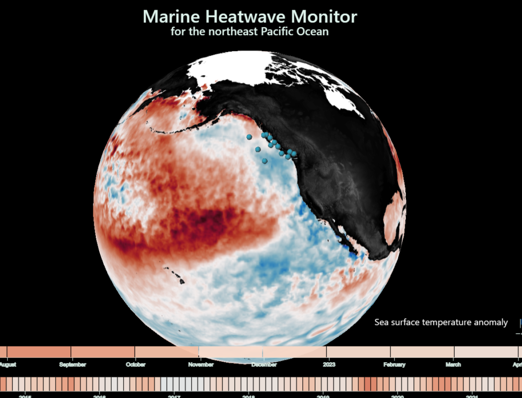
Comprehending the ocean of data within CIOOS could take many lifetimes. With the help of the Pacific’s data tools, we can see how ocean data is applied to existing societal issues.
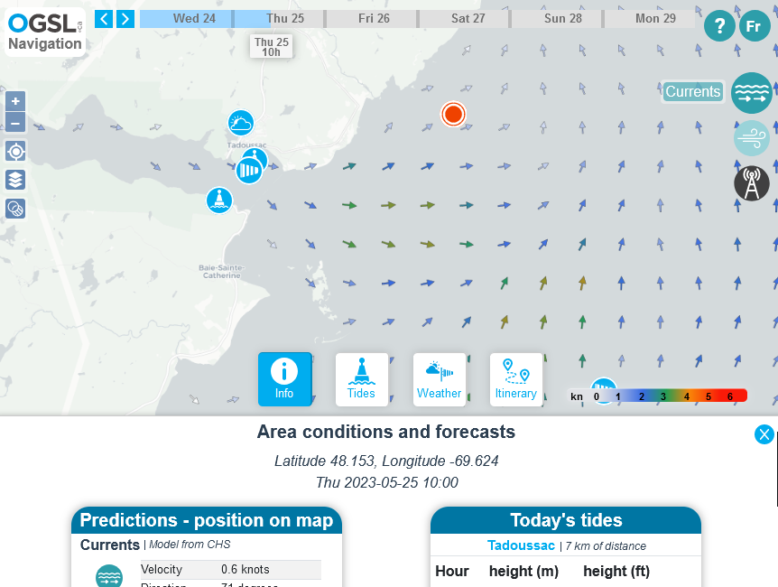
St. Lawrence Global Observatory Visualization Tools
SLGO’s visualization tools have been developed in collaboration with its partners to allow access to data for different needs such as marine conditions, navigation, biodiversity and much more.